Planning the Abrams Falls Hike? Read This First
Cades Cove has a way of turning “quick hike plans” into an all-day production, especially when the parking lot is full and the snacks are somehow already gone.
The Abrams Falls Trail is one of those hikes that looks simple on paper, then politely reminds everyone that roots, rocks, and a steady return climb are not opinions.
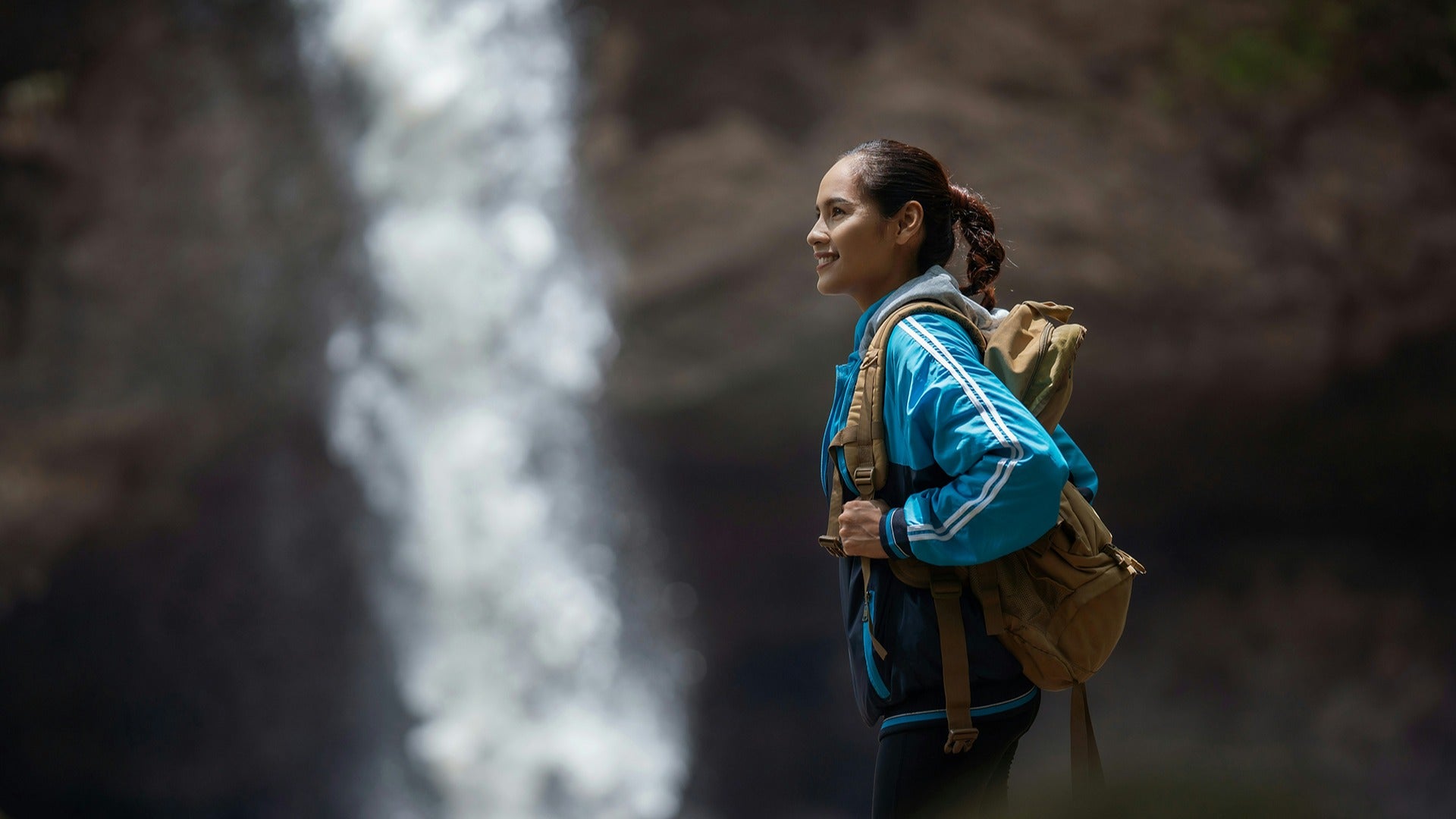
Half the battle is knowing what to pack so the trail doesn’t turn into a sweaty scavenger hunt for water, bug spray, and a bandage after that one foot slip.
The payoff at Abrams Falls feels even better when sore feet aren’t the loudest thing in the day.
This guide lays out exactly how to handle parking tags, trail conditions, timing, and the safety rules people ignore right until they shouldn’t.
Stick with it and hike the Abrams Falls Trail smarter from the first step to the final photo!
Abrams Falls Trail at a Glance: Quick Stats Before You Lace Up
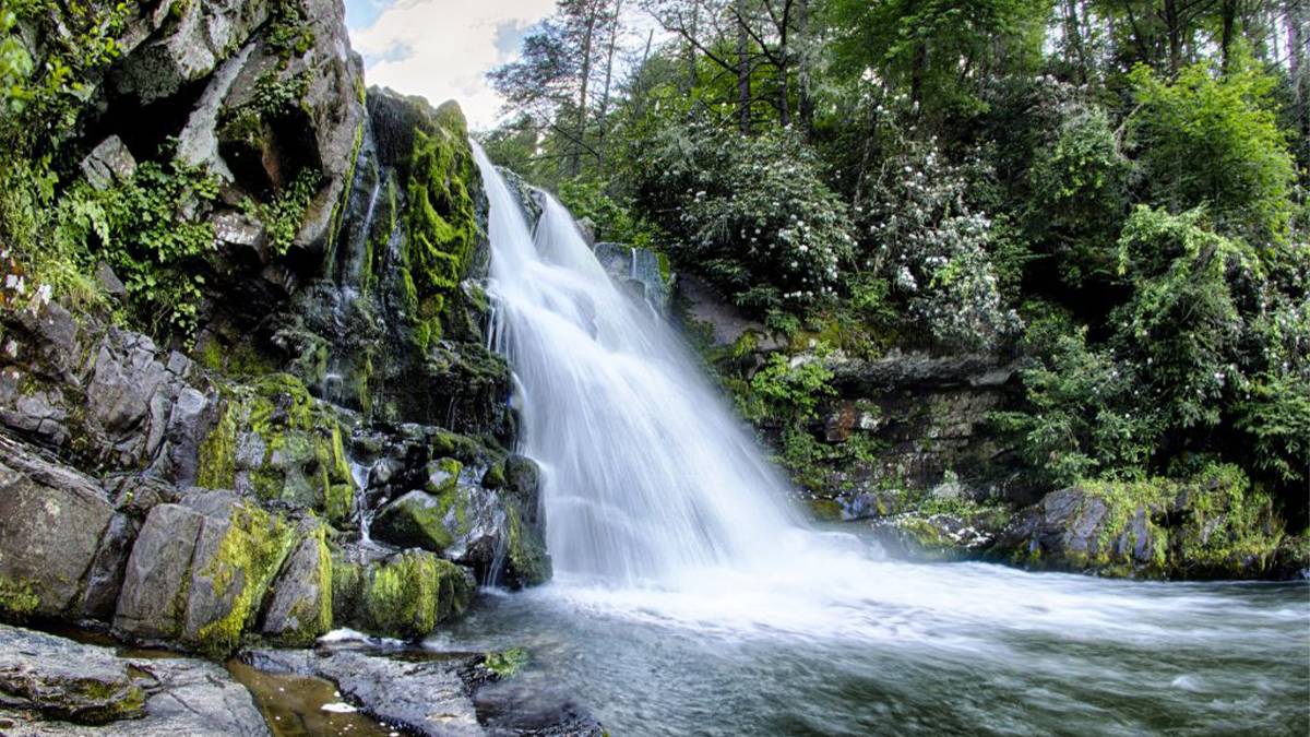
Abrams Falls is the Smokies’ “small-but-mighty” waterfall—about 20 feet tall, but with a serious rush of water that makes it feel way bigger.
The Abrams Falls Trail is a popular out-and-back hike that lands in the sweet spot between “easy stroll” and “why did I skip leg day,” thanks to rocky tread and roots.
Expect roughly 5.0–5.2 miles round-trip and 3–4 hours depending on how often you stop to sip water, snap photos, or negotiate with your calves.
Elevation gain usually falls somewhere around 340–550 feet, and the return can feel sneakier uphill than you remember on the way in.
The reward is a powerful cascade and a deep pool that looks inviting, until you remember it’s famously dangerous.
In short: Abrams Falls delivers big scenery without demanding a full-day epic, which is exactly why it stays booked and busy.
Getting to Cades Cove and the Abrams Falls Trailhead
The Abrams Falls Trail Cades Cove access starts on the Cades Cove Loop Road, a one-way scenic drive that’s part wildlife safari, part patience practice.
From Gatlinburg, you’ll generally approach via Little River Road toward Cades Cove, then enter the loop and follow it several miles to the Abrams Falls turnoff.
Watch for the Abrams Creek crossing—shortly after you cross it, you’ll turn onto a gravel road leading to the trailhead parking area.
If you’re visiting in peak seasons, go early unless you enjoy parking-lot laps that count as “bonus cardio.”
Keep in mind that Cades Cove can move slowly (bears, bikes, and rubbernecking are all valid speed bumps).
Once you’re parked, you’re officially in Abrams Falls Cades Cove territory—where the views start before you even touch the trail.
Parking Tags, Pit Toilets, and Cades Cove Logistics
The parking lot is large and has pit toilets, which is great news because nature calls even when you’re trying to “travel light.”
A valid GSMNP parking tag is required if your vehicle is parked longer than 15 minutes anywhere in the park, and you can’t buy one at the Abrams Falls trailhead, so plan ahead.
Tags are typically purchased online or at visitor centers, so don’t make “we’ll just figure it out” your strategy here.
Also note: the Cades Cove Loop Road is closed to motor vehicles on Wednesdays (early May to late September), which is dreamy for cyclists and walkers but changes your approach.
Crowds are real, especially mid-morning through afternoon, so early arrival is the simplest way to save time and sanity.
Treat the loop like part of the experience. Slow down, enjoy it, and don’t be the person trying to pass a deer.
What the Trail’s Really Like: Rocks, Roots, and a “Sneaky” Uphill Return
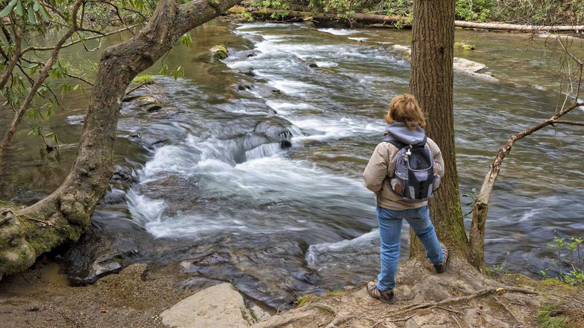
The Abrams Falls Trail follows Abrams Creek through classic Smokies scenery—forest shade, creek-side views, and enough roots to remind you that hiking is not a smooth-surface sport.
The path is generally wide and well-worn, but it’s still rocky in places, with footing that can be slick after rain.
You’ll roll through gentle ups and downs on the way to the falls, then suddenly realize the “easy” stroll out is a steady climb back.
Expect a moderate hike overall: doable for most active visitors, but you’ll want supportive shoes and a little patience on uneven sections.
Spring brings wildflowers and lush greens; summer brings humidity and crowds; fall brings color and “wait, why is it still warm?” weather.
Translation: it’s never a bad trail. Just pick the version of “Smokies conditions” you like best.
The Abrams Falls Hike, Step by Step (Out-and-Back Guide)
From the trailhead, you’ll head out on a clear, straightforward route that tracks along the creek for much of the way, with plenty of scenic distractions.
The falls sit about 2.5 miles one-way, so pace yourself as you’ve still got a return trip (because you do).
If you’re the “I need details” type, pull up an Abrams Falls Trail map before you go. Cell service can be spotty, and guessing games are better left to board nights.
Along the way, keep an eye out for small pull-offs and creek views that make perfect snack-and-sip stops.
As you approach the falls, you’ll notice more people, more camera pauses, and that unmistakable sound of rushing water doing its best dramatic entrance.
Once you arrive, take your time. Abrams Falls is the kind of spot that makes even a granola bar taste earned.
Camera Roll Worthy Stops: Best Views and Photo Angles
Abrams Falls is photogenic from multiple angles, but your best shots usually come from stable, dry rock, not from that tempting “just one step closer” slick spot.
For waterfall photos, aim for morning or late afternoon light when it’s softer, and use the darker forest backdrop to make the rushing water pop.
Creek-side sections on the Abrams Falls Trail also deserve a few frames. Those quiet, reflective stretches are the Smokies’ version of “calm before the roar.”
If you’re using a phone, wipe your lens (waterfall mist is basically nature’s fingerprint magnet) and try a short burst mode for sharper water action.
Want that classic “standing near the falls” photo? Choose a safe viewpoint and let the waterfall do the flexing—no need for cliff-edge heroics. The goal is great photos and an intact ankle, in that order!
Read This Before You Go: Safety, Wildlife, and Trail Rules
First, the big one: the pool at Abrams Falls looks like a natural swimming hole, but it’s extremely dangerous due to strong currents and undertow. This isn’t the place to “test it for a second.”
Stay on the bank, keep kids close, and treat wet rocks like they’re covered in banana peels (because they basically are).
Wildlife is part of the deal in Abrams Falls Cades Cove. Bears are active in the area, so carry food securely, give animals space, and don’t turn a sighting into a close-up mission.
Trail rules matter here: no dogs and no bicycles on the Abrams Falls Trail, and yes, the park enforces it.
Pack out every scrap, keep noise reasonable, and let faster hikers pass without making it a social negotiation.
If you’re the kind of person who reads Abrams Falls trail reviews, you’ve seen the theme: most “bad experiences” start with ignoring common-sense safety.
When to Hike Abrams Falls for the Best Water + Fewer Crowds
If you want fewer people and a smoother Cades Cove drive, go early. Like “before the group chats wake up” early.
Spring is a favorite for wildflowers and comfortable temps, plus the creek and falls often run strong with seasonal water flow.
Summer delivers lush scenery, but also heat, humidity, and the kind of crowds that make you grateful for wide trails.
Fall is gorgeous, but popular, so plan for slower traffic in Cades Cove and fuller parking lots, especially on weekends.
After heavy rain, conditions can be slippery, so dial up caution and dial down rock-hopping ambitions.
For the best balance of scenery and sanity, aim for a weekday morning outside peak summer whenever you can.
What to Pack for Abrams Falls (And What You’ll Regret Forgetting)
- Start with proper footwear—trail shoes or hiking boots with grip are the difference between “nice hike” and “why am I sliding.”
- Bring plenty of water, especially in warm months, because the Abrams Falls Trail is longer than it feels when you’re distracted by scenery.
- Snacks are a must, and if you pack anything fragrant, store it smartly and keep it close—wildlife doesn’t need your trail mix recommendations.
- Trekking poles can be a game-changer on rocky sections and for the uphill return, especially if your knees like to file complaints.
- Toss in a light rain layer and a small first-aid kit; the Smokies love surprise weather and minor scrapes.
And yes, download or screenshot an Abrams Falls Trail map ahead of time—signal isn’t guaranteed, but your confidence should be.
Roll Through Cades Cove in an Open-Air Pink Jeep: The Zero-Stress Scenic Upgrade
Pssst…Seeing Abrams Falls is a guaranteed Smokies highlight, but the Cades Cove part of the day can turn into a slow-moving puzzle of traffic, wildlife jams, and figuring out which pull-off is actually worth it.
If the goal is to soak up Cades Cove scenery and history without doing the driving math, a guided ride is the easiest upgrade!
The Cades Cove Tour in an Open-Air Jeep from Pigeon Forge, TN is a guided ride along the iconic 11-mile, one-way Cades Cove Loop Road in a custom Pink Jeep Wrangler, built for comfy sightseeing.
It departs from Smoky Mountains Pink Jeep Tours at 2611 Parkway in Pigeon Forge, so it’s an easy add-on when your day already includes the Parkway, Dollywood-area hotels, or dinner plans.
The experience runs about 4.5 hours and includes stops at historic highlights like pioneer cabins, churches, and the Cable Mill area.
Expect a scenic drive through Wears Valley and Townsend (aka the “Peaceful Side of the Smokies”) before you loop into the wide meadows and mountain views that make Cades Cove famous.
Ready to Turn This Hike Into a Whole Smokies Win?
The Abrams Falls Trail is the kind of hike that feels even better when the rest of the day runs just as smoothly.
Seeing Abrams Falls is a solid highlight, but it hits different when parking plans, timing, and your post-hike meal aren’t a scramble.
Planning the rest of the trip is the easy upgrade—lock in vacation packages through Tripster so the logistics don’t chew up your vacation hours.
From Pigeon Forge attractions, shows, and hotels to the extra experiences that round out Cades Cove day trips, we help you bundle and book with less guesswork.
Build a flexible itinerary, compare options in one place, and secure deals before the popular picks sell out.
Keep the momentum going and turn this trail day into a full Smokies getaway you’ll actually enjoy from start to finish!
Abrams Falls FAQs
How hard is the Abrams Falls Trail, really?
Most hikers rate it moderate because of rocky footing, roots, and a steady climb on the way back. It’s not technically difficult, but it can feel tougher if you’re not used to uneven terrain or if it’s hot/humid.
How long does the hike take?
A typical out-and-back takes about 3–4 hours for most visitors. Faster hikers can do it quicker, but budgeting time for rests and the falls area usually makes the day more enjoyable.
Where is the trailhead and how do I get there?
The trailhead is inside Cades Cove in Great Smoky Mountains National Park, accessed from the one-way Cades Cove Loop Road. You’ll turn onto a short gravel spur road to reach the Abrams Falls parking area.
Do I need a parking tag and where do I buy it?
Yes—GSMNP requires a valid parking tag if you park longer than 15 minutes anywhere in the park. Buy it online or at a visitor center before you arrive, because you can’t purchase a tag at the Abrams Falls trailhead lot.
Is there a good Abrams Falls trail map I should use?
Use an official park map or a reputable offline-capable trail app, then screenshot/download it before you lose service. The route is straightforward, but having a map helps with confidence, timing, and knowing exactly where you are in Cades Cove.
Can you swim at Abrams Falls?
Swimming is strongly discouraged because the pool has powerful currents and undertow, and drownings have occurred there. Enjoy the view from the bank and keep away from slick rocks near the waterline.
Are dogs allowed on the Abrams Falls Trail?
No—dogs aren’t allowed on the Abrams Falls Trail, even on leash. Leave pets at home or stick to the park’s pet-friendly areas and the limited trails where pets are permitted.
What should I wear and pack for the hike?
Wear grippy hiking shoes or trail runners, and bring more water than you think you’ll need—especially in warm months. Pack snacks, a light rain layer, bug spray, and a small first-aid kit for blisters or minor scrapes.
What do Abrams Falls trail reviews usually mention about crowds and timing?
Most Abrams Falls trail reviews flag crowded parking and heavy foot traffic during late morning through afternoon, especially on weekends and peak seasons. The easiest fix is an early start, which also gives you cooler temps and better chances at calmer viewpoints.